mail_outline sales@mediastorehouse.com
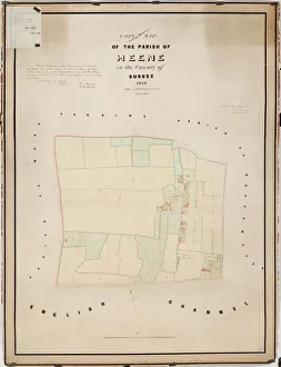
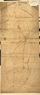
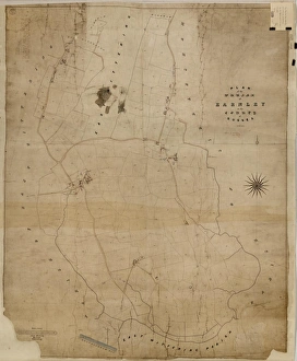
Heene tithe map, 1838By Hide and Patching, Surveyors &c. Worthing. 26.6 in. to 1 m. 48 × 35 Tithe Award Map Collection West Sussex Record Office Ref No: TD/W66
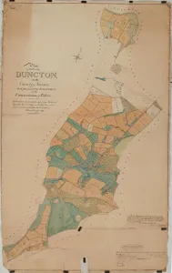
Duncton tithe map, 1837The boundaries are principally copied from The Earl of Egremonts Manorial Maps, executed by Crow, and revised and corrected under the direction of William Knight. 16 in. to 1m
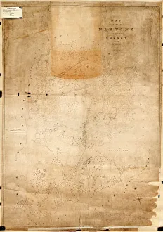
Harting tithe map, 1840From Shorto by D. Ayling, Liss, Petersfield. 13.3 in. to 1 m. 81 × 57 Tithe Award Map Collection West Sussex Record Office Ref No: TD/W65
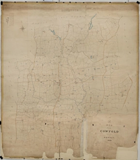
Cowfold tithe map, 1840By William Duncum, Reading, Berks. 26.6 in. to 1 m. 104 × 92 Tithe Award Map Collection West Sussex Record Office Ref No: TD/W154
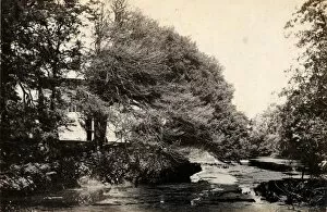
Sussex Bridge, Lindfield, 30 May 1891General Photographic Collection West Sussex Record Office, Ref No PH 26113/31
New Fishbourne tithe map, 1839By C. Lewis, Havant. 26.6 in. to 1m. 49 × 37 Tithe Award Map Collection West Sussex Record Office Ref No: TD/W87
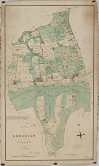
Edburton tithe map, 1842By E. & G. N. Driver, Parliament Street, London. 13.3 in. to 1m. 49 × 28 Tithe Award Map Collection West Sussex Record Office Ref No: TD/W168
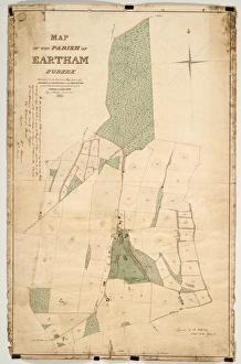
Eartham tithe map, 1840Enlarged from the Inclosure Map made in 1813. Revised and corrected to the present time for the Commutation of the Tithes of the Parish of Eartham. By J. Butler, Chichester. 13.3 in. to 1m
East Grinstead tithe map, 1840Surveyor unknown. 13.3 in to 1 m. 89 × 83 Tithe Award Map Collection West Sussex Record Office Ref No: TD/E45
Cuckfield tithe map, 1845Surveyor unknown. 8 in. to 1m. 53 × 42 Tithe Award Map Collection West Sussex Record Office Ref No: TD/E91
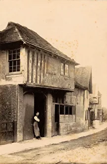
The old forge in Steyning, 27 July 1889The blacksmith is standing in the doorway, wearing a large leather apron General Photographic Collection West Sussex Record Office, Ref No PH 26113/116
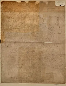
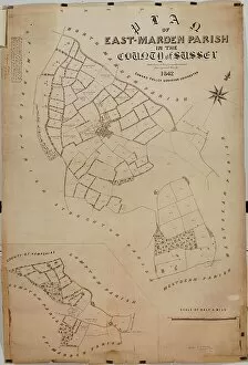
East Marden tithe map, 1842By Edward Fuller, Surveyor, Chichester. 20 in. to 1 m. 56 × 39 Tithe Award Map Collection West Sussex Record Office Ref No: TD/W49
West Hoathly tithe map, 1841By Thos. Hughes. 26.6 in. to 1 m. 147 × 83 Tithe Award Map Collection West Sussex Record Office Ref No: TD/E41
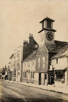
A street in Steyning, 27 July 1889This photograph shows a clock tower and several shop fronts, including a cobblers General Photographic Collection West Sussex Record Office, Ref No PH 26113/115
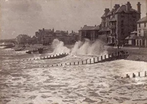
Rough seas at Bognor, 1900A view of the town from the pier, looking west John Fletcher Collection West Sussex Record Office, Ref No PH/26114/6
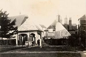
The lych gate at Cuckfield, 22 June 1894General Photographic Collection West Sussex Record Office, Ref No PH 26113/20
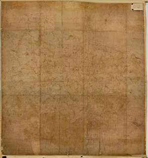
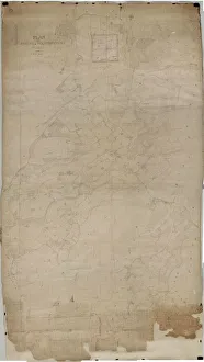
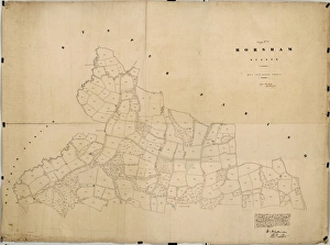
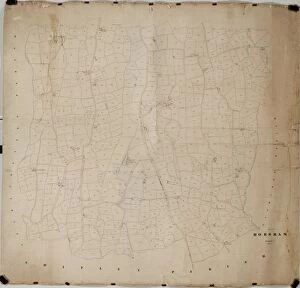
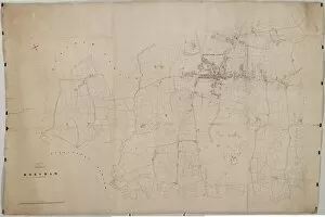
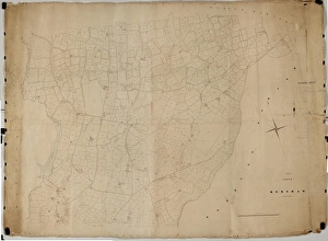
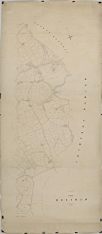
Horsham tithe map, c. 1844 (Part 1)No date, but Award 1844. Surveyor unknown. 26.6 in. to 1 m. Part I, 52 × 69; Part II, 78 × 106; Part III, 62 × 95; Part IV, 90 × 39; Part V
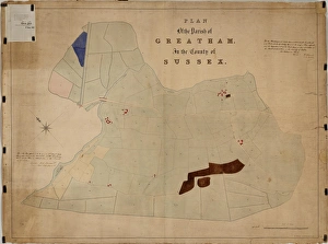
Greatham tithe map, c. 1837No date, but Award 1837. By R. Wright, 54 Gt. Ormond Street, London. 26.6 in. to 1 m. 37 × 49 Tithe Award Map Collection West Sussex Record Office Ref No: TD/W63
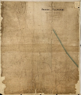
Felpham tithe map, c. 1844No date, but Award 1844. By Thomas Wisdom, South Bersted. 26.6 in. to 1m. 70 × 60 Tithe Award Map Collection West Sussex Record Office Ref No: TD/W54
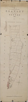
Crawley tithe map, 1839 (South section)By H. Walter, Windsor. 26.6 in. to 1 m. Part 1, 37 × 18; Part II, 37 × 26 Tithe Award Map Collection West Sussex Record Office Ref No: TD/W155
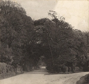
The mill at Plumpton Place, 22 June 1893General Photographic Collection West Sussex Record Office, Ref No PH 26113/44
Horsham tithe map, c. 1844 (Part 5)No date, but Award 1844. Surveyor unknown. 26.6 in. to 1 m. Part I, 52 × 69; Part II, 78 × 106; Part III, 62 × 95; Part IV, 90 × 39; Part V
Horsham tithe map, c. 1844 (Part 3)No date, but Award 1844. Surveyor unknown. 26.6 in. to 1 m. Part I, 52 × 69; Part II, 78 × 106; Part III, 62 × 95; Part IV, 90 × 39; Part V
Horsham tithe map, c. 1844 (Part 2)No date, but Award 1844. Surveyor unknown. 26.6 in. to 1 m. Part I, 52 × 69; Part II, 78 × 106; Part III, 62 × 95; Part IV, 90 × 39; Part V
Funtington tithe map, 1838 - 1839Copied from the Inclosure Award Map by Messrs. Driver, Whitehall [torn away], London; Revised and Corrected to the Present Time for the Commutation of the Tithes of the Parish of Funtington by J
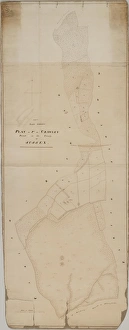
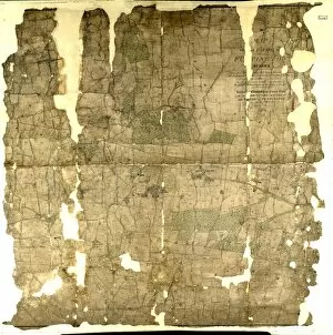
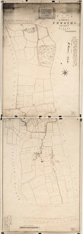
Ferring tithe map, 1837By Henry Salter. 26.6 in. to 1 m. Part I, 41 × 28; Part II, 41 × 28 (photographs) Tithe Award Map Collection West Sussex Record Office Ref No: TD/W56
Fernhurst tithe map, c. 1846No date, but Award 1846. Surveyor unknown. 26.6 in to 1 m. 122 × 85 Tithe Award Map Collection West Sussex Record Office Ref No: TD/W55
Easebourne tithe map, c. 1847No date, but Award 1847. Surveyor unknown. 26.6 in. to 1 m. 108 × 68 Tithe Award Map Collection West Sussex Record Office Ref No: TD/W45
Donnington tithe map, 1839By E. Fuller, Chichester. 26.6 in. to 1m. 73 × 31 Tithe Award Map Collection West Sussex Record Office Ref No: TD/W40
Crawley tithe map, 1839 (North section)By H. Walter, Windsor. 26.6 in. to 1 m. Part 1, 37 × 18; Part II, 37 × 26 Tithe Award Map Collection West Sussex Record Office Ref No: TD/W155
The Upper Brighton Road in Shoreham, 1897John Fletcher Collection West Sussex Record Office, Ref No PH 26116/113
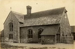
The old hospital in Rye, 5 November 1892General Photographic Collection West Sussex Record Office, Ref No PH 26113/52
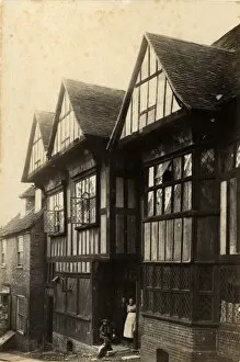
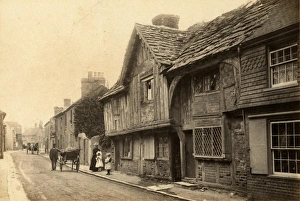
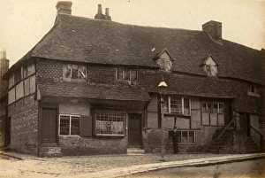
West Tarring: a street scene, 17 July 1891A woman and two young girls are standing in front of a row of old timber-framed cottages, and men with horses and carts can be seen in the background General Photographic Collection West Sussex
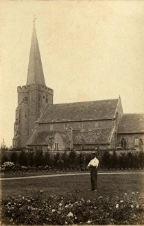
West Tarring: St Andrews Church, 17 July 1891A well-dressed man can be seen standing in the foreground, with the church in the background General Photographic Collection West Sussex Record Office, Ref No PH 26113/120
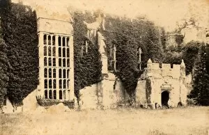
Midhurst: Buck Hall (Cowdray ruins), 24 June 1893Shows trees growing through the ruined building General Photographic Collection West Sussex Record Office, Ref No PH 26113/111
Bognor: road leading to Bersted Lodges gates, 1898Bersted Lodge was part of Aldwick Manor, which was home to the photographer (John Fletcher) and his family John Fletcher Collection West Sussex Record Office, Ref No: PH 26114/2
The mill pond at Plumpton Place, 22 June 1894General Photographic Collection West Sussex Record Office, Ref No PH 26113/45
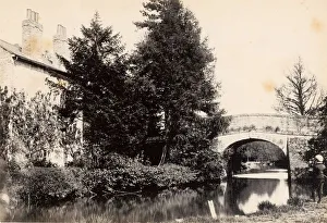
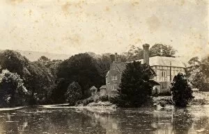
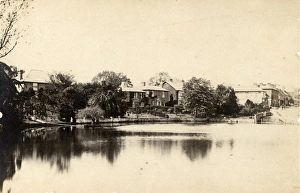
Houses surrounding the banks of the river in Lindfield, 30 May 1891General Photographic Collection West Sussex Record Office, Ref No PH 26113/33
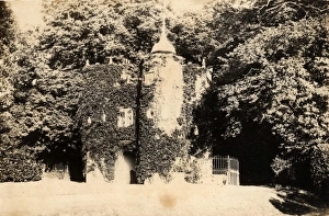
The lodge at the entrance to Cuckfield Park, 28 September 1895General Photographic Collection West Sussex Record Office, Ref No PH 26113/19
Horsham tithe map, c. 1844 (Part 4)No date, but Award 1844. Surveyor unknown. 26.6 in. to 1 m. Part I, 52 × 69; Part II, 78 × 106; Part III, 62 × 95; Part IV, 90 × 39; Part V
Earnley tithe map, 1845By Alfred Mellersh, Surveyor, Godalming. 26.6 in. to 1m. 62 × 49 Tithe Award Map Collection West Sussex Record Office Ref No: TD/W43
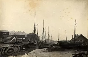
Rye: boats moored in Sussex Harbour, 5 November 1890General Photographic Collection West Sussex Record Office, Ref No PH 26113/50
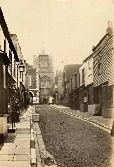
Rye: Lion Street, 5 September 1890General Photographic Collection West Sussex Record Office, Ref No PH 26113/49
West Tarring: Becketts Place, 17 July 1891General Photographic Collection West Sussex Record Office, Ref No PH 26113/119
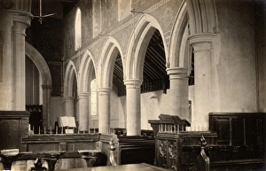
West Tarring: the interior of St Andrews Church, 17 July 1891General Photographic Collection West Sussex Record Office, Ref No PH 26113/118
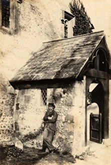
Sompting: the Church of St Mary, 3 April 1893A well-dressed man can be seen leaning against the porch General Photographic Collection West Sussex Record Office, Ref No PH 26113/114
Midhurst: cottages on Knockhundred Row, 24 June 1893A man can be seen standing in front of the cottages. These cottages are now occupied by Midhurst Library. General Photographic Collection West Sussex Record Office, Ref No PH 26113/112
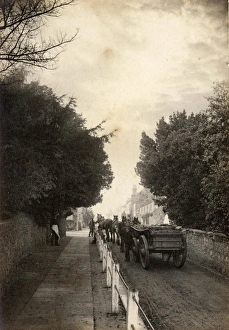
A team of horses pulling a cart up a street in Winchelsea, 6 November 1890General Photographic Collection West Sussex Record Office, Ref No PH 26113/55