mail_outline sales@mediastorehouse.com
Choose a picture from our Printed Maps Photo Mug Collection for your Wall Art and Photo Gifts
4 Photo Mugs
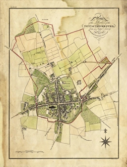
Map Of Chichester, 1812Map includes area outside of the city walls. Plan of the liberties of the City of Chichester from an actual survey taken April 1812 by George Loader
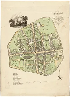
Map of Chichester within the City Walls, 1812Plan of the city of Chichester from an actual survey taken April 1812 by George Loader, Surveyor Printed Maps Collection West Sussex Record Office Ref No: PM 154
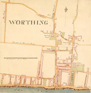
Street Plan of Worthing c1830Shows Warwick House and gardens, Wortley House, Marine Library, Sea House Hotel, and New Town (built c1820s on what is now Clifton Road)
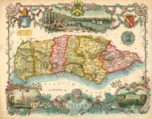
Map of Sussex, 1837Map of Sussex coloured to show the six Sussex Rapes. Map engraved for Thomas Moules English Counties Deliminated by W Schmollinger with inset views of Brighton Chain Pier, Chichester Cathedral