mail_outline sales@mediastorehouse.com
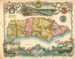
Map of Sussex, 1837Map of Sussex coloured to show the six Sussex Rapes. Map engraved for Thomas Moules English Counties Deliminated by W Schmollinger with inset views of Brighton Chain Pier, Chichester Cathedral
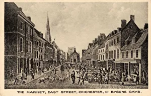
The market, East Street, Chichester in Bygone daysPostcard taken from engraving by M Dubourg, after the oil painting by J F Gilbert of Chichester, published in June 1814 Postcard c1900
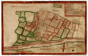
Map of the Manor of Middleton, 1606Map of the Manor of Middleton, surveyed by John Norden, showing land in the south-west of the Parish of Middleton, including buildings such as St Nicholas Church that are now under the sea Additional
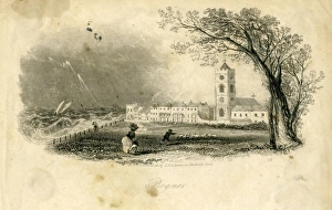
Engraving of Bognor seafront and St Johns Chapel in the SteyneView of Bognor published by J & E Harwood of Fenchurch Street, mid 19th Century Prints and Drawings Collection West Sussex Record Office Ref No: PD 853
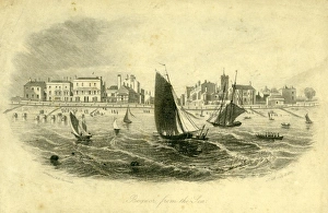
Engraving of Bognor viewed from the SeaView of Bognor published 9 July 1841 by J & E Harwood of London Prints and Drawings Collection West Sussex Record Office Ref No: PD 852
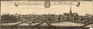
Engraving of North Prospect of ChichesterView of Chichester from the north including the City Walls and Cathedral, early 18th Century Fuller Collection West Sussex Record Office Ref No: F-PD 370