mail_outline sales@mediastorehouse.com
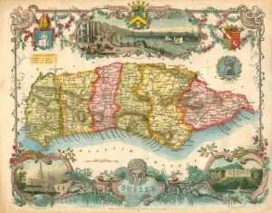
Map of Sussex, 1837Map of Sussex coloured to show the six Sussex Rapes. Map engraved for Thomas Moules English Counties Deliminated by W Schmollinger with inset views of Brighton Chain Pier, Chichester Cathedral
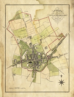
Map Of Chichester, 1812Map includes area outside of the city walls. Plan of the liberties of the City of Chichester from an actual survey taken April 1812 by George Loader
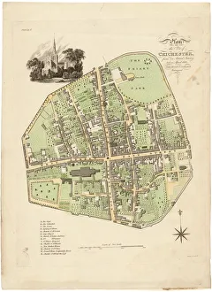
Map of Chichester within the City Walls, 1812Plan of the city of Chichester from an actual survey taken April 1812 by George Loader, Surveyor Printed Maps Collection West Sussex Record Office Ref No: PM 154
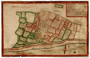
Map of the Manor of Middleton, 1606Map of the Manor of Middleton, surveyed by John Norden, showing land in the south-west of the Parish of Middleton, including buildings such as St Nicholas Church that are now under the sea Additional