mail_outline sales@mediastorehouse.com
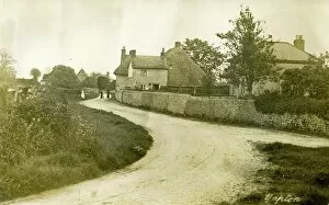
Village Street, Yapton, West SussexView of the village street with 3 people and the church visible in the distance Photographic Collection West Sussex Record Office Ref No: PH 1194
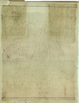
Billingshurst Tithe Map, 1841By Messrs. Crawter, Surveyors, Cobham, Surrey and Southampton Buildings, Chancery Lane, London. 13.3 in. to 1m. Original map size 78in. × 63in
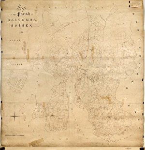
Balcombe Tithe Map, 1842By H. Walter. 20 in. to 1 m. Original Map size 79in. × 77in. Tithe Award Map Collection West Sussex Record Office Ref No: TD/E24
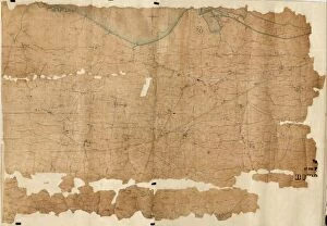
Birdham Tithe Map, c. 1847No date, but Tithe Award dated 1847. Surveyor unknown. 26.6 in. to 1 m. Original map size 46in. × 66in. Tithe Award Map Collection West Sussex Record Office Ref No: TD/W16
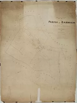
Barnham Tithe Map, 1846By Thomas Wisdom. 26.6 in. to 1 m. Original map size 65in. × 50in. Tithe Award Map Collection West Sussex Record Office Ref No: TD/W10
Upper Beeding Tithe Map, 1842By J. & E. Smith, Surveyors. 26.6 in. to 1 m. Original Map Size 112in. × 94in. Tithe Award Map Collection West Sussex Record Office Ref No: TD/W165
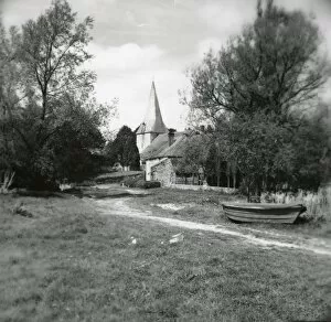
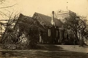
St John the Evangelist Church, Bury - 27 April 1948View along the path to the church with a 12th century tower and cedar shingled spire. Church is by the river Arun and there was at one time a passenger ferry by rowing boat to Amberley on the east
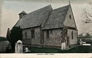
Albourne Church exterior, 1903Black and white postcard. Hordern Collection General Photographic Collection West Sussex Record Office, Ref No PH 5000
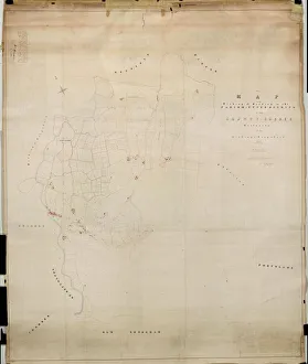
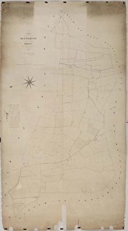
Binderton Tithe Map, 1847By John Elliott, Surveyor, Chichester. 26.6 in. to 1 m. Original map size 83in. × 42in. Tithe Award Map Collection West Sussex Record Office Ref No: TD/W14
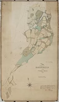
Barlavington Tithe Map, 1840Surveyor unknown. 16 in. to 1 m. Original map size 56in. × 32in. Tithe Award Map Collection West Sussex Record Office Ref No: TD/W9
The north side of the church at Beeding, 23 March 1893Probably the church at Upper Beeding Photographic Collection West Sussex Record Office, Ref No PH 26113/81
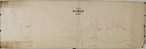
Bramber Tithe Map, c. 1839No date, but Tithe Award dated 1839. Surveyor unknown. 26.6 in to 1 m. Original map size 27in. × 82in. Tithe Award Map Collection West Sussex Record Office Ref No: TD/W20